The LEX, Coby and the Big Smoke: Do you speak Kawartha Lakes?
From forgotten crossroads to a village that refused its official name, Kawartha Lakes has a language all its own. Learning it is part of feeling at home.
Someone tells you they’re heading to the LEX, taking a drive up to Coby or going down to the Big Smoke.
If you’ve lived here long enough, you don’t need a translation.

The LEX is the Lindsay Exhibition. Coby is Coboconk. The Big Smoke is Toronto, although T.O. works just as well.
Around here, intersections have nicknames, vanished businesses remain landmarks and people give directions using townships that ceased to exist as separate municipalities in 2001.
You can live in Kawartha Lakes for years, know your way from Lindsay to Bobcaygeon and pronounce Omemee without hesitation, yet still discover another map of the area.
It’s the one locals carry in their heads.
The names that wouldn’t disappear
Even the word “city” can cause confusion.
When someone complains that “the city” hasn’t fixed a road, they mean municipal government. When someone says they’re “going into the city,” they probably mean Toronto.
In 2001, Victoria County and its municipalities were amalgamated into the City of Kawartha Lakes. (Today, we try to shorten that to Kawartha Lakes as often as possible.) Suddenly, a patchwork of farms, villages, towns and lakes was officially a city.
The change was contentious, but the old county name never disappeared.
For many longtime residents, Victoria County remains a perfectly good name.
Governments can change boundaries. They can’t necessarily change what people call home.
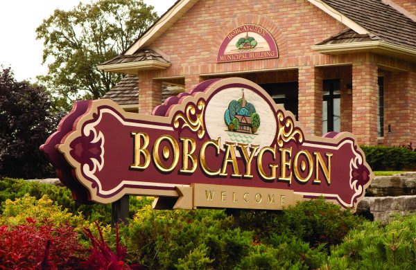
Bobcaygeon offers an earlier example.
In 1834, Lt.-Gov. Sir John Colborne named a village plot near the narrows between Sturgeon and Pigeon lakes Rokeby. The neighbouring settlement developed by Thomas Need was known as Bobcaygeon.
Both names were used, but Bobcaygeon prevailed.
The name has Indigenous roots, commonly interpreted as referring to water flowing around rocks.
Two nearby channels are still known as Big Bob and Little Bob.
Out in Pigeon Lake, one island has three names: Big Island, Boyd Island and Chiminis, reflecting its Indigenous history and later ownership by the Boyd family.
Even the water has a family history
An old county history described Mariposa Township as fertile farmland worked by generations of families.
Four concessions along Lake Scugog, once part of Cartwright Township, became Mariposa’s lettered concessions A, B, C and D.
Those old survey divisions help explain the layout around Cottage, Rainbow Ridge and Bowen roads. The road names are familiar today, but the lettered concessions survive in property descriptions.
Try explaining that to someone looking for Concession 1.
Mariposa Brook has also been called Big Creek, Black Creek, Davidson’s Creek and West Cross Creek.
Five names for one creek.
On Balsam Lakes, saying you have a cottage tells someone only half the story.
Romany Ranch? Indian Point? Long Point? Killarney Bay? South Bay?
Two cottages might be a short boat ride apart but a long drive by car. The shoreline community’s name tells locals which road to take.
On Sturgeon Lake, generations of Lindsay families have called Sturgeon Point simply “the Point.”
By the 19th century, families were summering there, sometimes arriving with servants and livestock. Some men commuted to work by steamer.
Anglers have names for their favourite spots, too.
Good luck getting them to share.
When the sign changes but the name stays
Sometimes a name outlives the reason for it.
Take Suicide Corners, the old nickname for the intersection of highways 7 and 35, back when stop signs, not traffic lights, controlled the crossing.
Drivers joked that you took your life in your hands just getting through it.
The lights eventually arrived. The nickname stayed.
Fenelon Falls offers another example.
The village was once known as Cameron’s Falls, after landowner Duncan Cameron, but the name gradually fell out of use.
Other names proved harder to shake.
The Alpine Inn once stood above the Fenelon Falls gorge. Originally Clifton House, it became the Alpine Inn in the 1930s and later operated under other names.
According to Maryboro Lodge Museum, residents continued calling it the Alpine Inn.
The building was destroyed by fire in 1970, but the name survived in local memory.
The sign could change. The vocabulary didn’t.
Why we talk this way
Why do people keep using names that disappeared from official maps decades ago?
To find out, we asked Martin R. Boyne, a PhD assitant professor and coordinator of the Languages & Linguistics Program at Trent University.
He says these expressions are part of our regional dialect, which includes more than accents. It encompasses words particular to a community, including names for streets, waterways and landmarks.
Linguists call place names toponyms, and Boyne says they’re among the most enduring parts of a language.
“Both official and unofficial names for places are among the most resilient vocabulary items in a language.”
That helps explain why Victoria County survives in conversation and why the Alpine Inn remained the Alpine Inn after its name changed.
The names persist through conversations, stories and directions. They can also reveal who’s talking. Someone who calls Sturgeon Point simply “the Point” may have spent summers there since childhood.
The old names aren’t just directions. They’re shared memory.
But will they survive as Kawartha Lakes changes?
New residents are arriving and familiar communities are growing.
Boyne says older speech patterns can be surprisingly resilient.
“It’s a bit of both, but remarkably older patterns do tend to stick around.”
Regional dialects face pressure from globalization, he says, but fears that everyone would eventually speak alike haven’t become reality.
Some expressions may fade. Others will survive as newcomers adopt them, sometimes without knowing their origins.
Boyne is optimistic.
“I’d say that local peculiarities like the ones you’re describing have a very strong chance of survival.”
You must be from around here
A farmer in Mariposa, a snowmobiler near Kinmount and a cottager at the Point may describe Kawartha Lakes in different terms.
But their words tell a common story about a place where people remember what came before.
For newcomers, it starts small.
Someone explains where Coby is. A neighbour mentions an old crossroads. A friend invites you to the LEX.
Before long, you’re using the same names yourself. One day, without noticing, you’ll give directions using a landmark that disappeared 30 years ago.
That’s when you know you’re beginning to speak Kawartha Lakes.
Now it’s your turn
What did your parents or grandparents call the crossroads, hills, swimming holes, fishing spots and old businesses in your community?
Visit the Kawartha Lakes Weekly Facebook page, find this story and share your favourite local name, what it means and, if you know, how it originated.
Let’s keep those names and stories alive for the neighbours just getting to know the place we call home.
Because the most interesting map of Kawartha Lakes may be the one that has never been printed.